
Geomedicine - Explore Your Place History

Geomedicine – Explore Your Place History
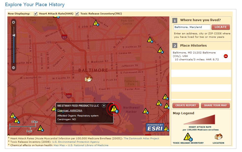
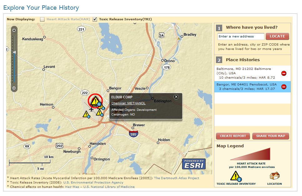
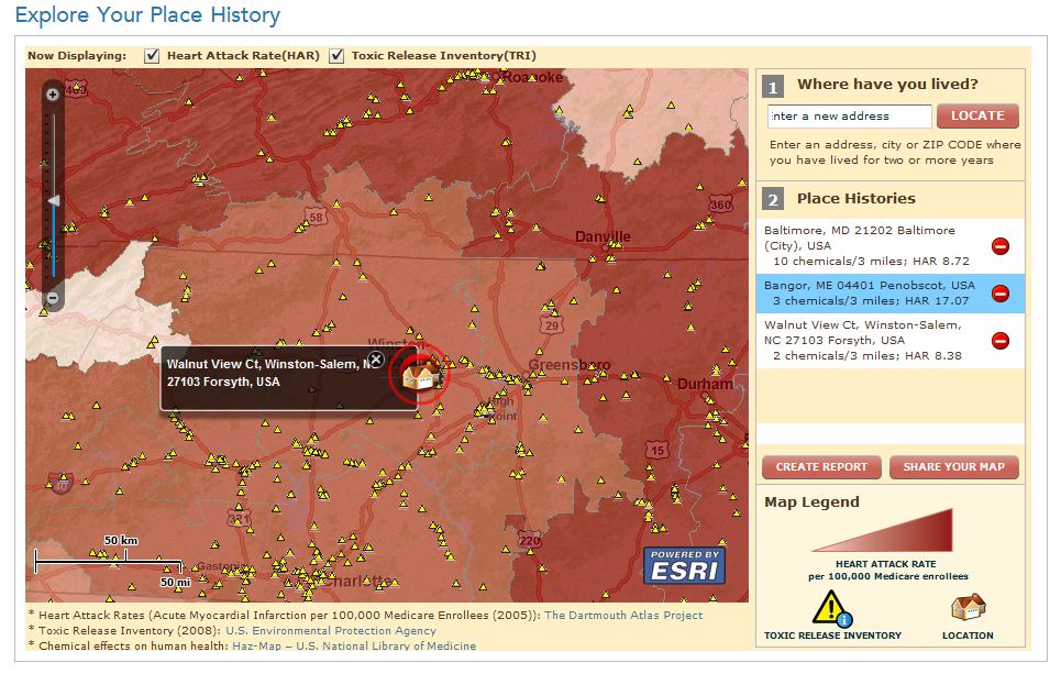
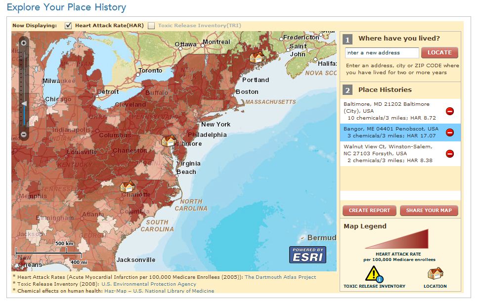
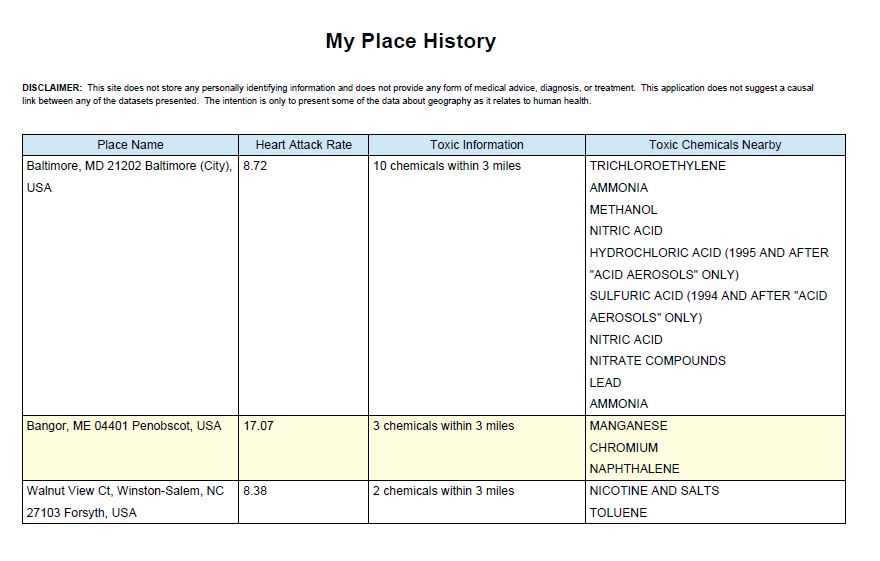
This web-based app uses Esri’s ArcGIS Server with the ArcGIS API for Flex to link public health information with your environmental experience. Use it to get a greater understanding of how your local environment can affect your health.
Using U.S. street addresses to create and maintain a personal place history, you can gather general information about your proximity to environmental hazards or exposures and unlock a wealth of geographically relevant health information.
Geomedicine – Explore Your Place History links your personal place history to several governmental data sources including
- Dartmouth Atlas of Health Care
- Toxic Release Inventory (TRI) of the United States Environmental Protection Agency
- Haz-Map—U.S. National Library of Medicine
In addition to creating your own personal place history, you can also create a customized map to share with others or embed on your own website.
0 comments